Looking for a reliable GIS team to avoid going through the technology investment and hiring process when your needs are unpredictable? Or, perhaps you have a dedicated internal GIS guru or team, but could benefit from leaning on an experienced group when your internal resources are inundated? Our sizeable GIS division offers the bandwidth and national expertise desired for a one stop shop support system. We are recognized for high quality deliverables and acclaimed for our responsiveness and attentiveness. With a substantial and long term investment into ArcGIS desktop, web, and server technology, we embrace our core value of innovation and commitment to best and class services for our clientele.
.
Across all industries, you will notice that WLS fuels its service lines with GIS directly and through our COMPASS platform, equipping project stakeholders with intel and tools they need for optimal performance and success. From direct support of long term projects to ad hoc requests, be it on-site or remote, WLS provides the ultimate and flexible location intelligence experience.
“EVERY SUCCESSFUL PROJECT BEGINS AND ENDS WITH A GREAT MAP” – JOHN WILSON, CEO WESTERN LAND SERVICES
MAPPING SERVICES
Make informed decisions and minimize risk by enlisting GIS / mapping support for your various projects.
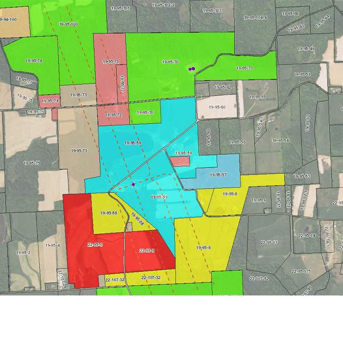
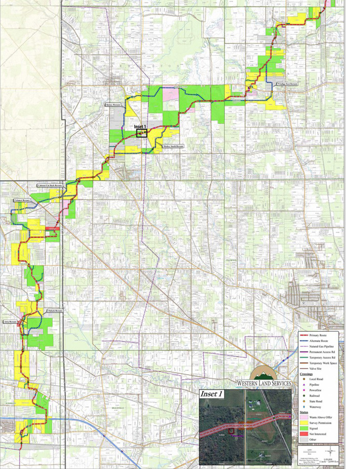
- Asset mapping
- Site analysis
- Slope and contour digitization
- Proposed and ‘as-built’ exhibit maps
- Route and line list digitization and maintenance
- Encumbrance (surface and subsurface) mapping
- Midstream dedication mapping
- Deed plotting
- Oil & Gas well production checks
- Data conversion and optimization
- Web map design, development, and workflow creation
- Geodatabase design and development
- In-house and remote services
- And more!
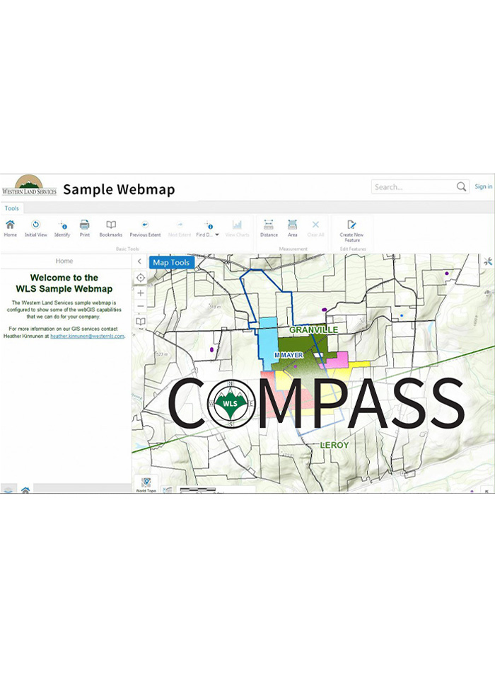
webgis: compass
Used both internally by our staff and externally by our clients, COMPASS, our WebGIS system, has become our project management application of choice. Operating on Esri ArcGIS for Server Technology and Geocortex software, our Compass team is capable of providing access to maps and data in a secure, user friendly forum. This powerful tool enables users access to real time data anywhere an internet connection exists. With the ability to extract data, generate reports, print maps, log contact reports, monitor overall project progress and more, this interactive platform promotes improved decision making and project management on a whole new level. Even better – no GIS experience is needed. Navigate to success with COMPASS today.
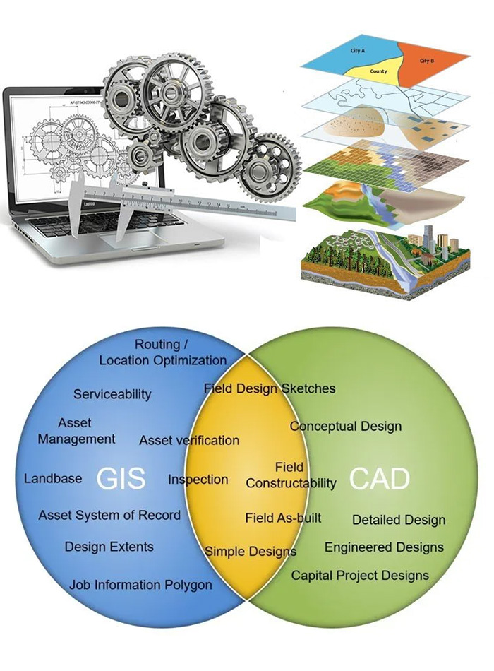
cad
In conjunction with utilizing ArcGIS software, WLS has team members versed in CAD software, with experience converting files to and from CAD and ArcGIS formats depending on the needs of our clientele. This shared expertise allows us to better collaborate with engineers and surveyors, retaining the ultimate ability to utilize the strengths of each software based on the use cases presented to us.
resources
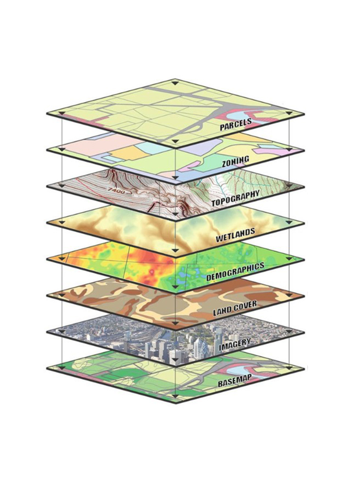
WLS utilizes an abundance of digital resources to support the various industries we work in, such as:
- Parcel, PLSS and OTLS boundaries
- BIA, State & Federal land ownership
- Tree species, type stands and boundaries
- Wetlands
- Coal strips
- Oil & gas wells, permits and lateral locations
- Storage fields
- Lease / unit boundaries
- Cultural data (zoning, endangered species, conservation land, etc.)
- Wind turbines
- Topography and aerial imagery
- Pipeline routes, Substations, and transmission lines
- Warrant, historic & tax map overlays
- Railways
- And more!
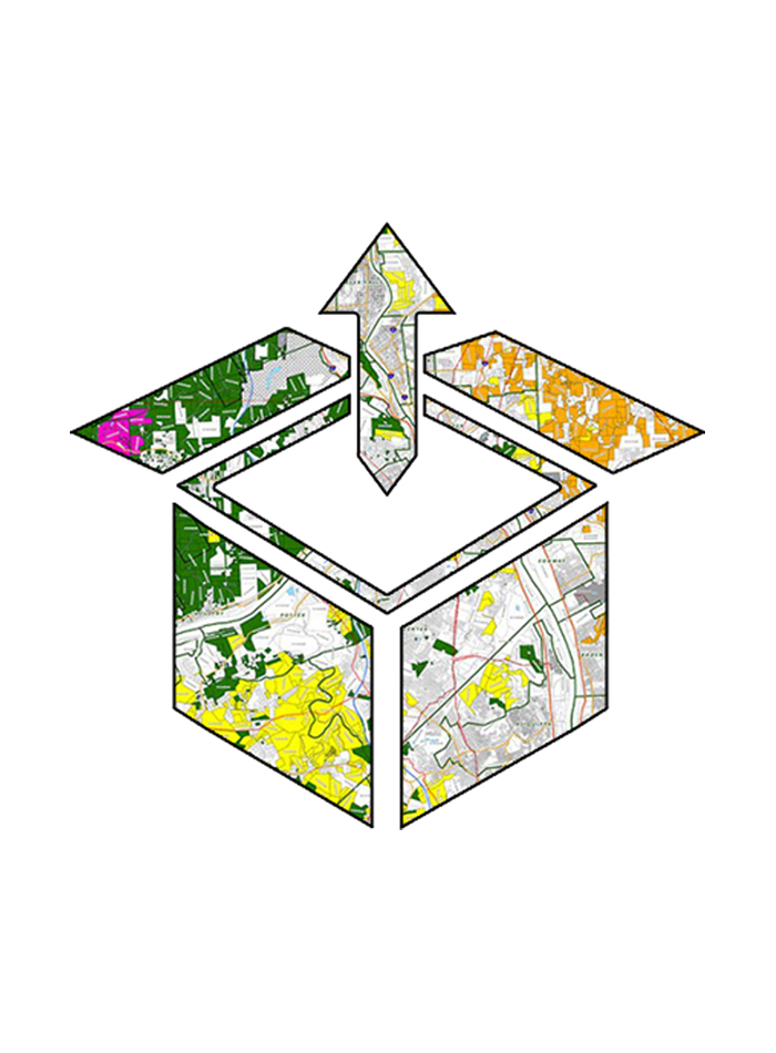
deliverables
WLS offers customized products including, but not limited to:
- Digital and/or printed maps
- Shapefiles and/or Geodatabases
- Layer files
- KMZ/KML, DWG, Geojson, etc.
- Map and feature services
- Web map solutions